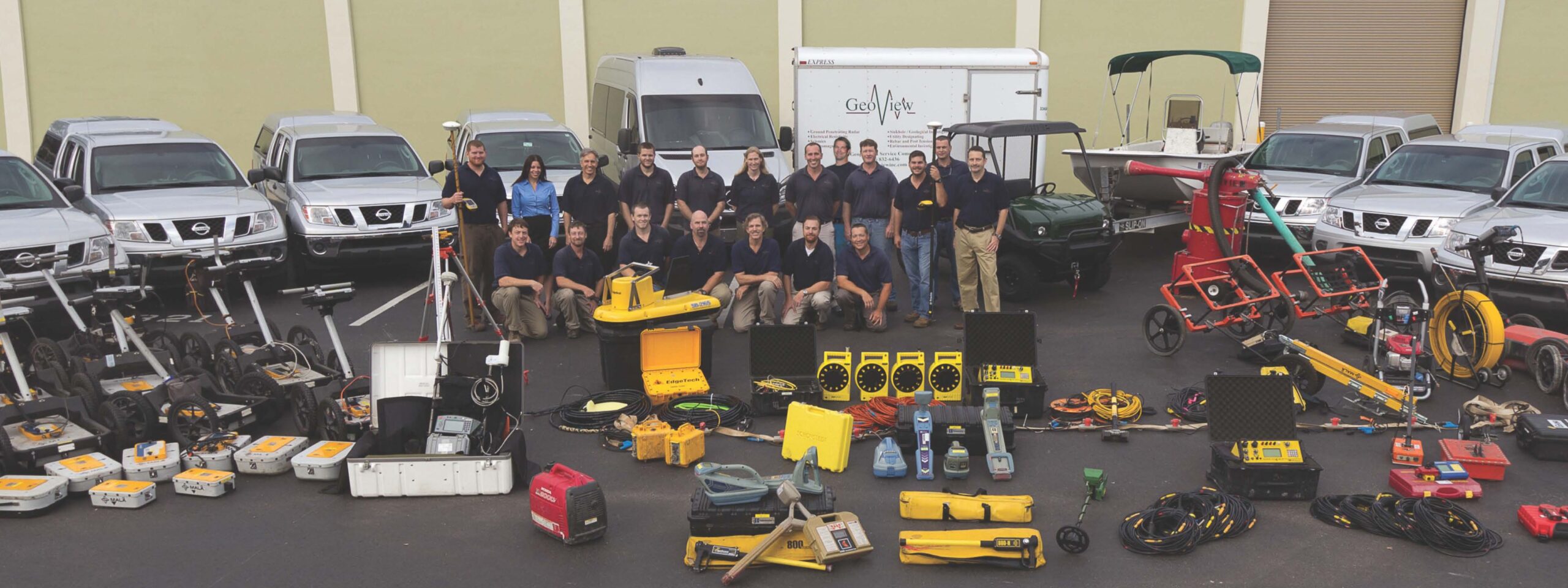
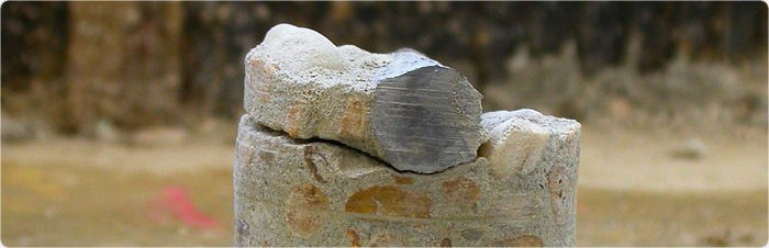
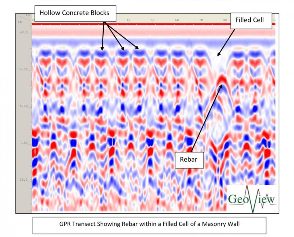
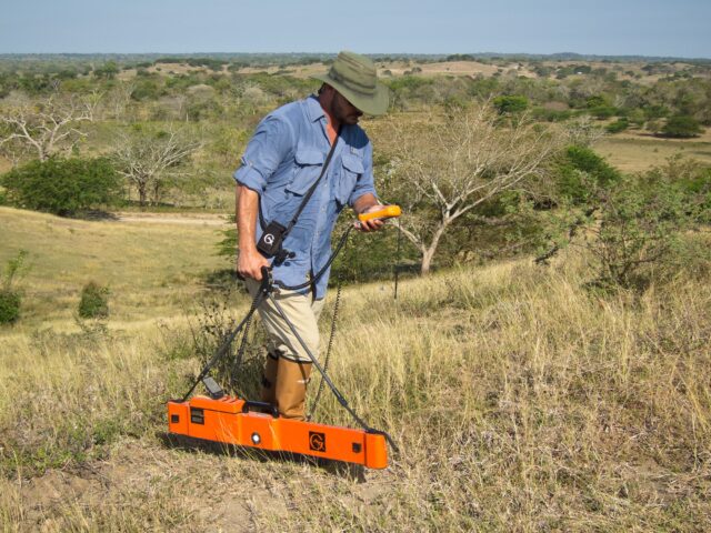
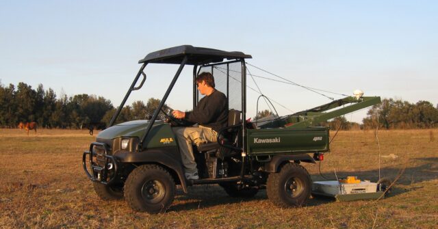
GeoView specializes in the provision of geophysical services to the engineering, geological, environmental and construction industries. Our services include geologic and infrastructure investigations, utility and rebar locating, environmental surveys, archaeological studies and marine surveys.
Mike Wightman helped cofound GeoView in 2001. He has over 35 years of experience in the application of surficial geophysical testing methods for environmental, geotechnical, geological, hydrogeological, infrastructure and non-destructive testing of concrete structures related projects. He has a master’s degree in Geology from the University of South Florida with a specialization in surficial geophysics and karst hydrogeology and an undergraduate degree in Geology from the University of California Santa Barbara. He is a professional Geologist in the States of Florida and California. He was past President of the USF Geology Alumni Society and was recognized as the Outstanding Geology Alumni in 2024.
He has provided expert testimony, authored multiple publications and delivered numerous presentations in regard to geophysical testing for a wide variety of applications. He is an expert in application of surficial geophysical methods in understanding karst systems. Prior to GeoView he was the Senior Geophysicist and Operations Manager at SDII Global Corporation.
Mike’s is responsibilities include overall company oversight, project management and budgeting, employee supervision and training, design and implementation of geophysical investigations, data evaluation, numerical and analytical modeling of geophysical data, marketing and business development. He is currently focused on expanding the use of geophysical testing technologies for the non-destructive testing of concrete structures. His personal passions include Tae-Kwon-Do and white/flatwater kayaking.
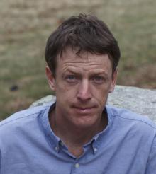
Chris Taylor helped co-found GeoView in 2001. He manages GeoView’s Northeastern office and has over 30 years of experience in the application of surficial geophysical testing methods to environmental, geotechnical, geological, hydrogeological, infrastructure and construction-related projects. He has a bachelor’s degree in Earth and Environmental Sciences with specialization in Geophysics from Lehigh University He is a professional Geologist in the States of Florida and Pennsylvania.
He is an expert in multiple geophysical testing methods including seismics and borehole geophysics. Prior to GeoView he was the geophysics project manager at Vibra-Tech Engineers, Inc. and SDII Global, Inc. He has extensive expertise in the analysis and integration of geophysical results into large scale geotechnical and environmental investigations. He has worked extensively through out the United States, Central and South America and the Caribbean.
Chris’s responsibilities include senior project management, design and implementation of geophysical site investigations, project management, employee development and ensuring that GeoView is employing state-of-the-art geophysical technologies and software to meet client objectives. He is currently focused on the integration of various geophysical approaches for work on geotechnical and environmental related site investigations. His personal passions include cycling and freshwater fishing.
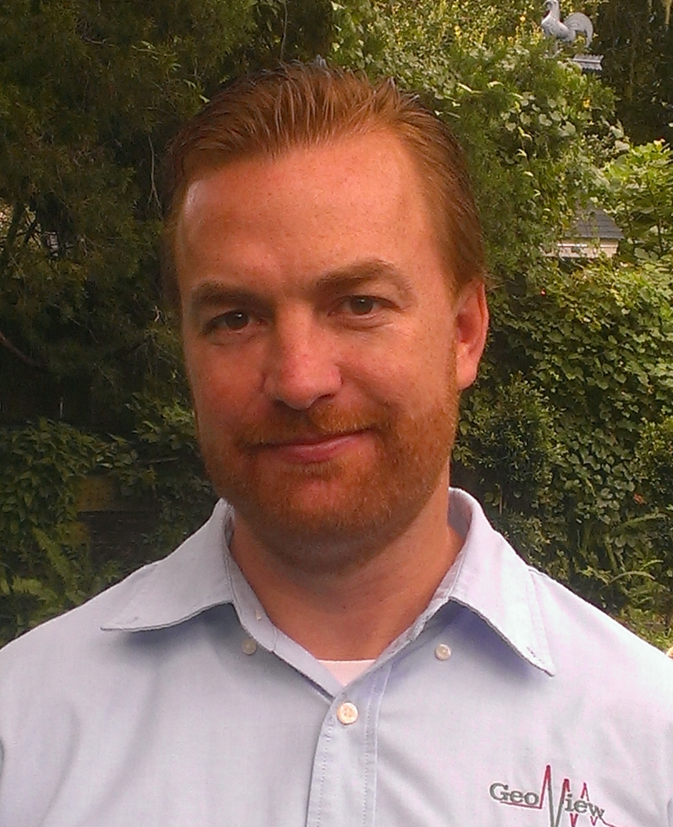
Steve Scruggs helps manage operations through the company and has over 25 years of experience in the application of surficial geophysical testing methods to environmental, geotechnical, geological, hydrogeological, infrastructure and construction-related projects. He has a master’s degree in Geology from the University of South Florida with specializations in geophysics and hydrogeology and a B.S in Geology from the University of Florida. He is a professional Geologist in the State of Florida.
He is an expert in multiple geophysical testing methods including ground penetrating radar, electrical resistivity imaging, electromagnetics and magnetometry. He has managed and/or completed geophysical investigations throughout United States, Central and South America and the Caribbean. Prior to GeoView he was a Geophysics Project Manager at SDII Global, Inc.
Steve’s responsibilities include senior project management, design and implementation of geophysical site investigations, advanced data analysis and report preparation, business development and client relations. He is currently focused on the development and cross-training staff integration of various geophysical approaches for work on geotechnical and environmental related site investigations. His personal passions include competitive long distance running and creative wood sculpture.
Mapping the Subsurface at USF: Supporting Campus Growth 🐂
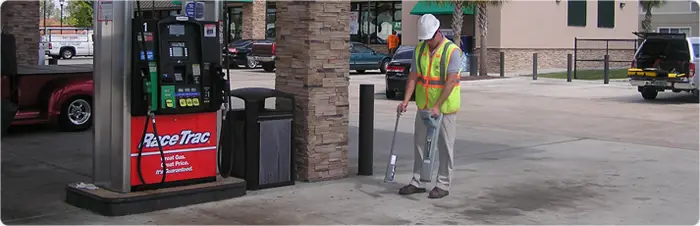
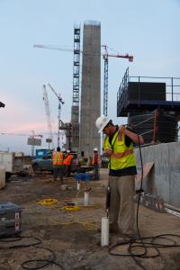
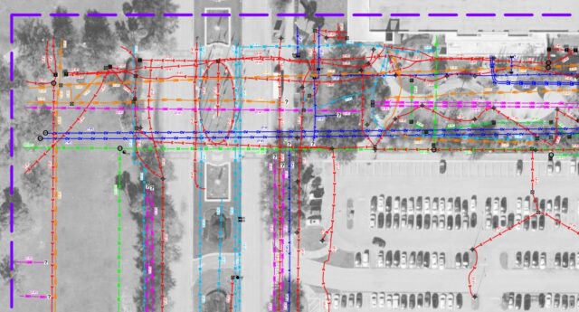
As the University of South Florida continues to expand its underground infrastructure, keeping a precise blueprint of existing utilities is critical for safe development. GeoView recently headed back to Tampa to perform a comprehensive Level B Subsurface Utility Engineering (SUE) study around the Muma College of Business.
The Mission:
The goal was to accurately locate and map a dense network of buried utilities—including power, water, chilled water, gas, communications, and sewer systems—to safeguard the area prior to future campus expansion.
The Technology Deployment:
Navigating a complex university environment requires a multi-tool approach to catch both metallic and non-metallic lines:
GPR & Electronic Utility Locators: Used in tandem to detect and trace conductive subsurface utilities.
Toneable Rodder: Deployed to access and track non-conductive stormwater and sanitary sewer pipes that can often be missed by standard radar.
Emlid RS3 GPS: Utility positions were captured in real-time kinematic (RTK) mode, delivering sub-foot horizontal accuracy.
The Results:
Our field data was seamlessly processed and delivered to the client in an AutoCAD format, allowing the findings to be effortlessly integrated straight into the University’s infrastructure archives.
At GeoView, we are proud to provide the precision mapping needed to keep campus infrastructure projects moving forward safely. Go Bulls! 🤘
https://geoviewinc.com/utility-locating-and-mapping-at-the-usf-muma-college-of-business/
#Geophysics #UtilityLocating #SUE #SubsurfaceUtilityEngineering #GPR #EmlidGPS #AutoCAD #USF #Tampa #GeoView
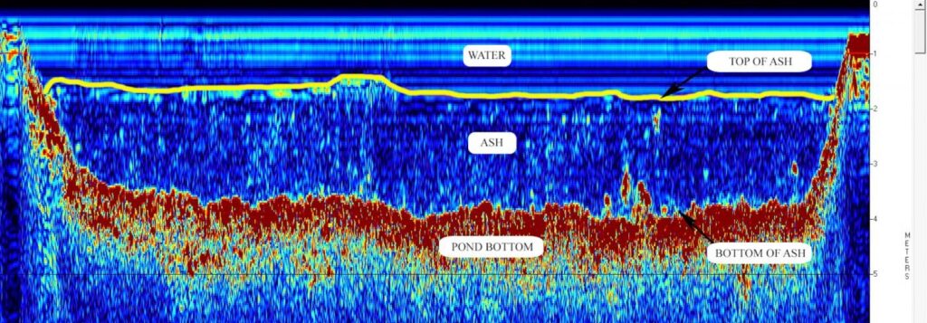
Precision Marine Profiling: Mapping Coal Ash Sediment Thickness 🌊🔋
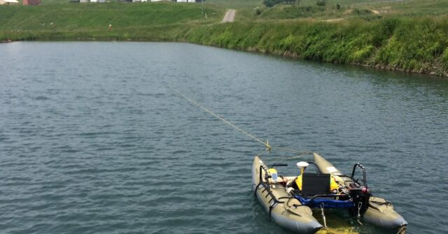
Recent updates to EPA regulations have made it essential for power plants to thoroughly evaluate existing ash ponds and determine the precise thickness of accumulated ash sediments. GeoView stepped up to deliver a highly effective, non-destructive solution for a facility in West Virginia.
The Mission
We were tasked with accurately mapping both the top and bottom interfaces of ash sediment across four separate ash settling ponds at a power plant.
The Challenge
Site-specific safety regulations meant we couldn't put personnel out on the water in a traditional manned vessel. The data collection required a creative, completely unmanned approach.
The Technology Deployment
To navigate the safety restrictions while maintaining extreme data accuracy, our team engineered a portable, shoreline-controlled survey setup:
Sub-Bottom Profiling System: We deployed an Edgetech 3100 topside system with a 216 towfish mounted to the underside of a portable pontoon boat.
Shore-Pulled Control: Instead of a motorized drone or a crewed vessel, the pontoon boat was safely pulled across the ponds by hand from the shore using a network of ropes.
The Results
Using Edgetech Discover software, our processing team calculated depths based on a velocity of 4,870 feet per second to deliver an exact model of the subsurface.
Dual-Interface Mapping: The survey successfully resolved distinct data for both the top of the ash sediment and the underlying pond bottom interface.
Contour Elevation Maps: We delivered detailed contour maps showing the precise elevations of the ash sediment layers.
https://geoviewinc.com/sediment-thickness-of-a-coal-ash-pond/
#Geophysics #SubBottomProfiling #MarineSurvey #Edgetech #CoalAshPond #EPARegulations #SiteCharacterization #GeoView
Case Study Monday is Back!
Mapping Beneath the Panama Canal: A Landmark Project 🚢🌎
How do you prepare to build a massive bridge over one of the most vital shipping lanes on earth? You start by mapping the bedrock under some of the most rugged, difficult terrain imaginable.
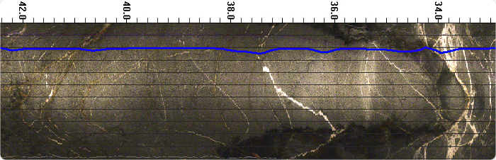
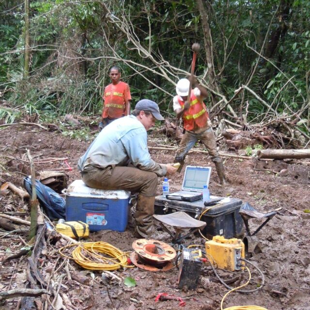
GeoView teamed up with an international consortium to tackle a high-stakes geotechnical investigation for the Autoridad del Canal de Panama (ACP), mapping out the subsurface velocity profiles along a 4-kilometer stretch north of the Gatun Lock.
The Challenge
The proposed footprint for the new Panama Canal bridge featured incredibly steep, heavily vegetated, and rugged terrain. Standard drilling equipment couldn’t easily access every location, meaning non-destructive, deep-imaging geophysics was critical to filling in the blanks.
The Technology Deployment
Our team deployed a powerhouse combination of seismic methods to capture both compression waves (P-waves) and shear waves (S-waves) down to depths of 30 meters:
The Breakthrough
The data revealed a stark geological contrast between the two sides of the canal:
The West Bank: The unweathered, solid Gatun Formation bedrock was found to be incredibly shallow—less than 5 meters below the surface.
The East Bank: Bedrock dropped significantly deeper, sitting between 25 to 28 meters down, blanketed by a thick layer of very soft fill and sediments.
Precision Anomalies: We also isolated localized low-velocity pockets, alerting engineers to weathered zones where thicker sediment had pooled over time.
Thanks to these highly detailed P-wave and S-wave velocity models, the engineering team received a flawless blueprint of the foundation conditions—ensuring the future bridge rests on solid ground.
#Geophysics #SeismicRefraction #MASW #PanamaCanal #GeotechnicalEngineering #CivilEngineering #Infrastructure #BridgeDesign #GeoView
Case Study Monday!
Uncovering Ancient Artifacts: Advanced Geophysics for Cultural Preservation 🏺🗺️
Before major infrastructure projects begin, ensuring that history isn't lost under the pavement is a vital step. GeoView took part in an extensive archeological investigation along a proposed pipeline route stretching from the Cordillera de Mérida mountain range in northeastern Colombia toward the Pacific Ocean.
The Mission:
Our team was tasked with surveying twelve distinct areas, each approximately 2,400 square meters, to identify buried Pre-Columbian artifacts prior to pipeline construction. The targets included everything from historic metal tools and pottery to ancient gold ear and nose rings.
The Technology:
Because the targets varied in material and depth, we utilized a multi-method geophysical approach across the grass and light underbrush terrain:
Frequency Domain Electromagnetics (EM-38): Using a Geonics EM38-MK2 in a vertical dipole orientation, we mapped soil bulk conductivity and inphase readings down to about 1.5 meters, capturing both ferrous (iron-bearing) and non-ferrous metals.
Total Field Magnetics: A Geometrics G-859 Cesium Vapor magnetometer was used to look deeper into the subsurface—sensitivities ranged from 2 to 5 meters depending on the target’s size and orientation.
Handheld Metal Detectors: To ensure nothing was missed, traditional handheld detectors were deployed to catch small, shallow metallic objects that the broader, deeper-sensing equipment might bypass.
The Results:
Over a three-week period, the combination of high-precision instruments and shallow-target sweeping successfully mapped out the sites.
Precision Excavation: GeoView provided comprehensive site maps and coordinates for each anomaly, allowing the archeological team to precisely excavate and document these invaluable historical artifacts before construction commenced.
Read More: https://geoviewinc.com/pre-columbian-artifacts/
#Geophysics #Archaeology #CulturalPreservation #PreColumbian #Electromagnetics #Magnetometer #SiteAssessment #PipelineEngineering #GeoView
We're back for another Case Study Monday!
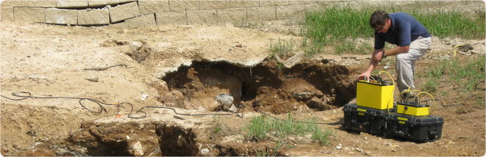
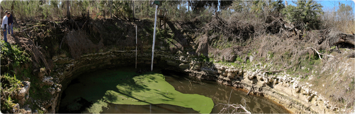
GPR and ERT: A Proactive Approach to Sinkhole Detection 🕳️🏗️
Identifying subsurface hazards before they impact a structure is critical for site safety and property value. GeoView performed a comprehensive geophysical investigation to evaluate the potential for sinkhole activity at a developed property.
The Mission:
The objective was to identify areas of loosened or "rarefied" soil and detect any deep-seated voids or structural anomalies that could indicate active sinkhole development beneath the surface.
The Technology:
To get a complete picture of the subsurface, our team utilized a dual-method approach:
Ground Penetrating Radar (GPR): Used to map the shallow subsurface. This allowed us to identify "down-warping" of soil layers, which is a classic indicator of soil subsiding into a deeper void.
Electrical Resistivity Tomography (ERT): This method provides a deep-profile view. By measuring the electrical resistance of the ground, we can distinguish between solid limestone, clay-filled voids, and air-filled cavities.
The Results:
The combination of GPR and ERT allowed us to pinpoint specific areas of concern without the need for extensive initial drilling.
Early Detection: We identified subsurface anomalies consistent with sinkhole activity, allowing the client to take proactive stabilization measures.
Comprehensive Mapping: Our 2D cross-sections clearly visualized the transition from stable ground to areas of concern.
Data-Driven Solutions: These findings provided engineers with the exact locations needed for confirmatory SPT (Standard Penetration Test) borings.
At GeoView, we provide the clarity and depth needed to protect your investments and ensure the ground beneath your feet is secure.
Visit our website to learn more: https://geoviewinc.com/sinkhole-investigation/
#Geophysics #Sinkhole #GeotechnicalEngineering #GPR #ElectricalResistivity #FloridaGeology #SiteInvestigation #ConstructionSafety #GeoView